The Cache la Poudre River, the heart of the National Heritage Area, is a working river essential to the lives of the more than a half-million people in its Basin.
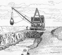
Originating among the Rocky Mountains and dropping some 7,000 feet to the Great Plains, the Cache la Poudre River is relatively short —125 miles from start to end. It flows eastward through diverse geographic settings, and in many areas, one can see head gates, flumes, and intricate networks of ditches. These structures symbolize the long struggle to sustain a viable agricultural economy and to meet the water needs of urban development for the people of northern Colorado. (Picture to the left: Machine Ditch Digger)
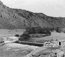 The Poudre River is significant for its contribution to the development of Western water law and the evolution of complex water delivery systems. The river has also played a crucial role in regional economic development and has become a focal point for recreation. (Picture to the left: Greeley Pipeline Diversion Dam)


